AGRICULTURE
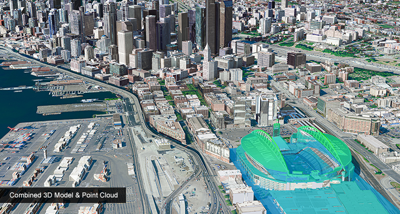
When you need to map the real world in a 3D environment, Hexagon US Federal’s City Mapper – 2 empowers you to quickly and accurately acquire airborne imagery for 3D Mapping applications.
Oblique sensors of the past that employed only the use of imagery can experience data occlusions and smearing. By incorporating oblique LiDAR, the CityMapper-2 sensor provides a more complete 3D rendering of your environment.
Download the City Mapper – 2 product sheet (PDF)
For more information on our City Mapper – 2, or for a demo or quotation, contact us today.